I have been an avid trail runner since middle school but wasn’t introduced to the wonderful Richmond trails until closer to the end of college. A really good friend that I ran with in high school and still actively run/hike/hang out with first introduced me to the North Bank Trail on the James River. The rest was history.
Most of these trails can be hiked, biked, or run on. Some can be pretty technical, but they’re also a great way to get out and explore so close to the city.
I say most because certain sections or parts of trails might be specifically for bikers or specifically for hikers/runners. But they’re all pretty well-marked.
Enough chit-chat, let’s jump right into the best Richmond trails!
Also, don’t forget to follow me on Instagram for more day-to-day adventures, @dougashphotography
North Bank Trail
It’s mostly single track with a good mix of shady trail under tree cover and wide open beautiful James River views. The trail is approximately 3 miles long, starting behind the Belle Isle Parking Lot and ending at the Nickel Bridge near Pump House Park. Or you can start/end in reverse, whatever your preference.
You can hop on the trail at the Texas Beach Parking Lot.

The trail itself is pretty friendly to hikers/walkers, and runners. There are a couple of technical spots but nothing super crazy. The views are well worth it! And you may even be able to spot the black bears at Maymont Park, as the trail goes right beside the enclosure for a bit.
North Bank Trail can then be connected to Buttermilk Trail by crossing Nickel Bridge to the south.

Buttermilk Trail
Once you start the Buttermilk Trail from the Nickel Bridge, it loops under the bridge and continues down along Riverside Dr.
This trail is definitely my favorite as it tightly weaves through the lush riverside greens and makes you feel as if you’re not in the city. There are not as many ‘views’ as North Bank Trail, but the tunnels of green more than makeup for it.

The trail runs about 3 miles and loops back to North Bank Trail on the other end via Belle Isle. Or you can enter in the middle via the Reedy Creek Parking Lot.
If you park at Reedy Creek, you can also check out another 3-mile loop on the other side of Riverside Dr, Forest Hill Park Trail Loop.
Forest Hill Park Trail Loop
This Richmond trail is pretty tough, with many climbs, and can be pretty difficult. But this is right up your alley if you’re trying to get a ‘mountain’ hike without actually going to the mountains.
The trail loop is about 3 miles, and it can be a little confusing to follow your first time out. It’s best to think of the loop as a circle and always to use the outermost trail when given a choice. But make sure to check the map board before jumping in.
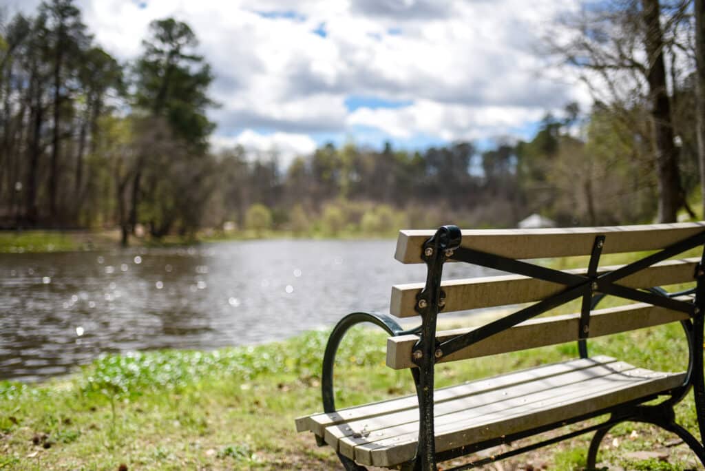
You can also hike on a paved trail around the lake. It offers some really pretty views in the spring.
You should check out the South Of The James Farmer’s Market if you’re out on a Thursday evening between 4 and 7 pm. It’s an awesome open-air local market with a bunch of good food and vendors.
And if you’re feeling super adventurous. You can even combine the Forest Hill Loop with the Buttermilk Trail and North Bank Trail to form a super 10-mile trifecta loop. These are easily my favorite running trails in Richmond, VA.
Belle Isle
You’ll use a section of Belle Isle if you want to connect Buttermilk with North Bank, but it’s also possible to complete a decent loop without including those trails.
By parking at the Belle Isle Parking Lot, you can cross the Belle Isle Pedestrian Bridge and hop on a wide hard packed trail that loops around the isle. The loop itself is a little less than a mile, but it offers great views of the James River, especially around sunset!
You can also get off the main hard-packed trail and up into the center of Belle Isle using a confusing set of single-track trails. I say confusing because they seem to be laid out like a spider web. But you don’t really need to worry about getting lost because it’s a pretty small network and will all lead out back to the main loop eventually.
“Poop Loop” (Ancarrow’s Landing)
I’ve only run this a few times, so I’ll need to check it out again soon and update this further. But this section is super popular with bikers and runners, even though it holds true to its name since it’s close to the city’s wastewater treatment plant.
It’s approx. a 2.5 to 3-mile loop starting at Ancarrow’s Landing within the Manchester neighborhood of Richmond.
If you’re interested in checking the “Poop Loop,” visit the RRRC’s Poop Loop 4ish Miler race page for a good loop you can try. Not sure if it’s running again this year (2021), but you can use the map and directions on that page.
Dogwood Dell Loop Mountain Bike Trail
I love this little simple loop. It’s not as busy as some of the other Richmond trails, and it’s super easy for me to get to. Especially on shorter trail days.
Just a straight shot down Belvidere to Pump House Park and park in front of the actual Pump House. The loop is about a mile, but you can add in the Carillon or Byrd Park exploration if you like.
There are a few climbs here, and it’s only one way, so if you’re hiking/walking/running, keep an eye out or for bikers coming up behind you.
James River Pipeline Trail
I almost did not include this because I wouldn’t consider it a classic trail. But it’s a pretty cool experience, has great views, and can be tied into the Canal Walk or be combined with Belle Isle and the trifecta loops.
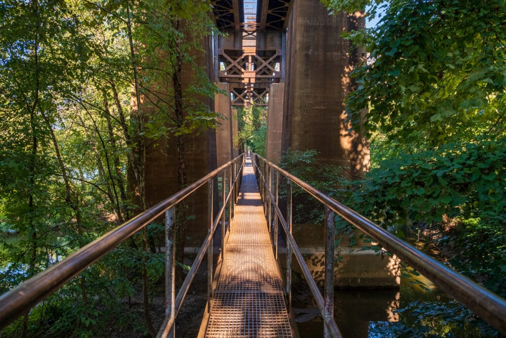
You can park close to it just past Casa Del Barco on the Canal Walk, but that parking can get tight. You’re better off parking at the Belle Isle Parking Lot, then walking down Brown’s Island to the Canal Walk area, then past that to the big flood wall. You’ll see a trailhead, then a short ladder climb down to the pipeline.
The Pirate Trail Loop
This is a new one for me. But for the past couple of months, I’ve been running with the East End Trail Running Group on a trail currently known as The Pirate Trail.
Normally that’s a tentative name for unsanctioned trails but I think this one may just stick even if it becomes sanctioned. It’s at least stuck with us as we’re running it.
It’s hard to explain where it goes but it’s on the east side of Richmond VA near Ghilles Park. We meet up at the Blue Atlas parking lot and take the roads about 1.5 miles to the trail system. Then another 3.5 miles on trails before finishing up with 1 mile on the road.
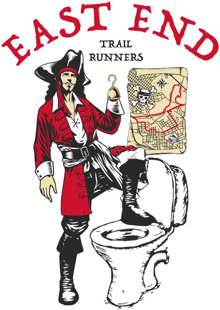
Above is the group’s logo which includes a treasure map that shows the loop. It’s terrible for directions and I’m sorry I can’t give you a turn-by-turn, but maybe that means you should just join our group.
Hiking Trails Pretty Close to Richmond VA
If you’re looking to go just outside the city but still within a 10-30 min drive. Check out a few more options below.
Pocahontas State Park
Pocahontas is huge! There are a lot of different hiking/biking/running trails to choose from so I’d recommend checking out their site/map for the best information.
I used to run cross-country races out there in high school. But now I don’t make it out there as much unless I want to get in a really long run.
It’s about a 25-30 min drive if you’re in Richmond.
Powhite Park Loop Trail
Powhite Park Loop Trail is about a 2-mile trail tucked away near Chippenham Hospital, about 10 minutes outside the city.
It’s really popular with bikers. And has a sweet section where you get to ride through a dried-out creek bed.
Rockwood Park Trail
Rockwood was my favorite trail running spot growing up in Chesterfield. They have a lot of paved trails for hiking/walking. But they also have some pretty decent trails for hiking and trail running.

You generally start off on the paved section of the trail depending on where you are in the park, but eventually, there are a number of paths that lead to the trails. These trails run beside a pretty big pond. Watch out for snakes in the summertime!
In Conclusion
I love having so many trail options within the city. And still get the feeling not as many people know about them. However, with everything going on with COVID, the trails have gotten a little busier. So make sure to listen out for “runner up” or bikers ringing their bells when hiking/walking the trails.
Enjoy the pictures, and maybe I’ll see you out there!
Give me a follow @dougashphotography to follow along as well!
Related Posts
Things To Do In Richmond VA – From A Photographer’s Perspective
Three Ridges – The Best Hiking Near Richmond VA
Pictures Of The Blue Ridge Mountains: A Collection Of My Favorites
Awesome job Doug . You know a lot about the running trails. I might see you out there one cool day
Much appreciated!! Will see you out there!